Intelligent Water Resource Solutions for a Sustainable Future

Harness the power of advanced geospatial technologies, satellite remote sensing, and AI-driven analytics to monitor, manage, and protect our most precious resource.

AquaSense Africa

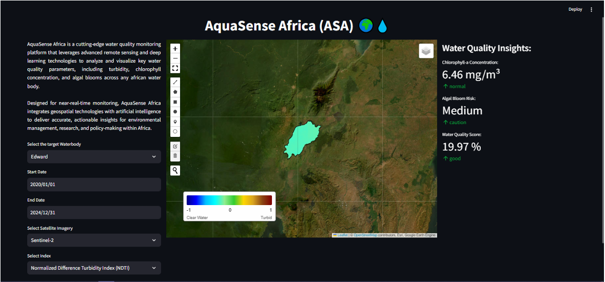
A cutting-edge water quality monitoring platform leveraging advanced remote sensing and deep learning technologies to analyze key water quality parameters across African water bodies.

Real-Time Monitoring

Continuous tracking of water quality indicators using Sentinel-2 and Landsat satellite data with weekly update frequency.

AI-Powered Analytics

Deep learning models trained on local water bodies for accurate assessment of turbidity, chlorophyll concentration, and sediment levels.

Early Warning System

Automated algal bloom detection, water quality degradation, and pollution events to enable rapid response.

AquaSense Africa Platform

Water Management Services

Integrated solutions covering every aspect of water resource management

Surface & Ground Water Mapping

We provide integrated water intelligence, precisely mapping surface water, tracking changes, and modeling aquifer recharge to empower sustainable resource management.

  • Water body delineation
  • Temporal dynamics tracking
  • Watershed analysis

Water Quality Assessment

Multi-parameter water quality monitoring using optical remote sensing and validated empirical models calibrated for local conditions.

  • Chlorophyll-a concentration
  • Suspended sediment analysis

Flood Risk Management

Advanced flood forecasting, inundation mapping, and risk assessment using hydrological modeling and terrain analysis.

  • Real-time flood monitoring
  • Predictive modeling
  • Vulnerability assessment

Ready to Transform Water Management?

Partner with us to leverage integrated water intelligence for sustainable resource management, from precise mapping to responsible extraction planning.