Built on Cutting-Edge Technology
GeoMind.AI models leverage the latest advances in deep learning and computer vision
TensorFlow & PyTorch
State-of-the-art deep learning frameworks
Google Earth Engine
Planetary-scale geospatial analysis
GPU Acceleration
High-performance computing infrastructure
Computer Vision
Advanced image analysis algorithms
GeoMind.AI Series for Developers
VEGETATION AI
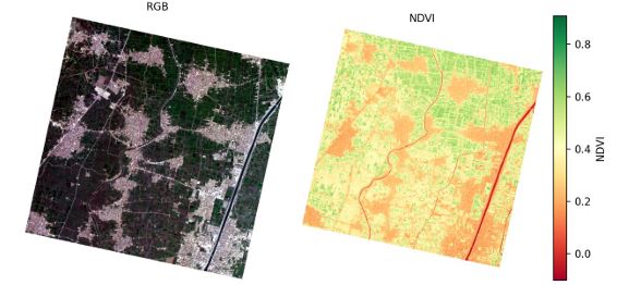
GeoMind BV-1 (Vector)
Converts RGB to NDVI and configured similar to Oman Lens (OL-1) satellite.
STRESS DETECTION
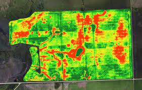
GeoMind AG-1 (Vigil)
Early detection of crop stress and nutrient deficiency
CLIMATE AI
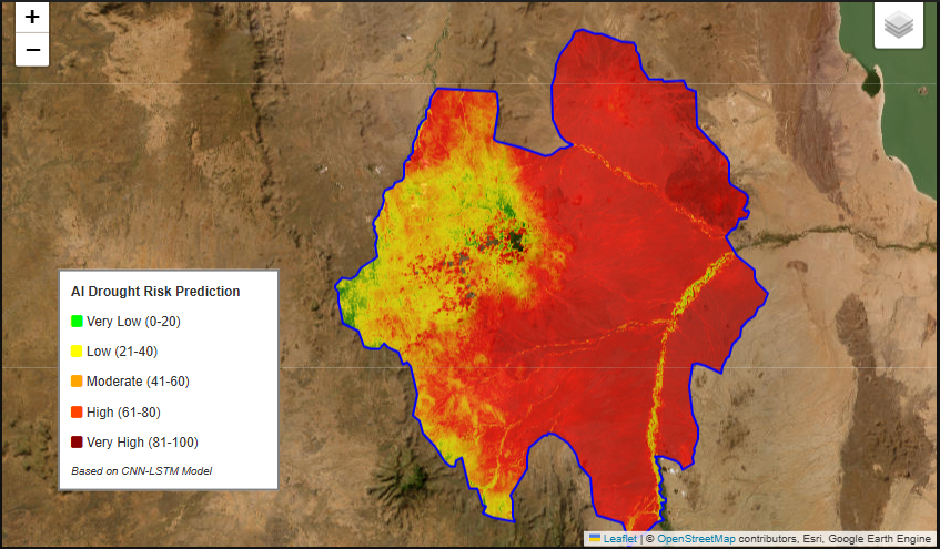
GeoMind HC-1 (Oracle)
Predict drought conditions up to 2-3 weeks in advance
LAND CLASSIFICATION
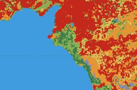
GeoMind TL-1 (Atlas)
Classify land use types from RGB imagery automatically
Proven Performance
Our models are rigorously tested and validated against industry benchmarks
95%+
Model Accuracy
<27s
Average Response Time