Comprehensive Geospatial Solutions

Environmental Monitoring
Advanced satellite-based monitoring solutions for environmental compliance and ecosystem management.
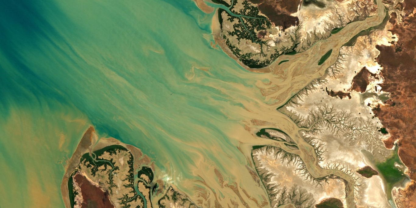
Hydrological Mapping
Precise hydrological intelligence mapping surface water dynamics, watershed linkages, and aquifer recharge for sustainable resource management.
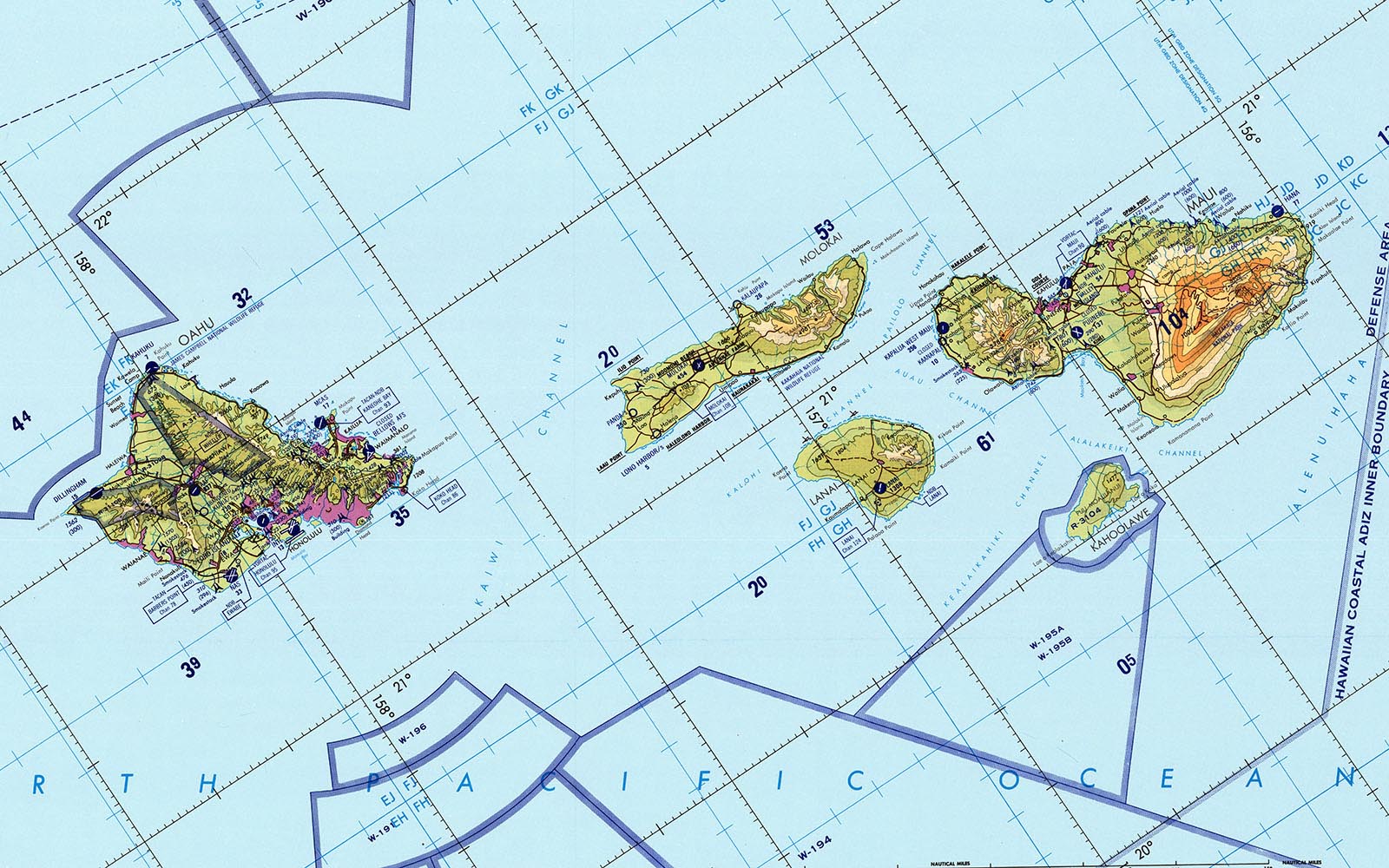
Cartography Solutions
Custom mapping solutions designed for your specific needs.
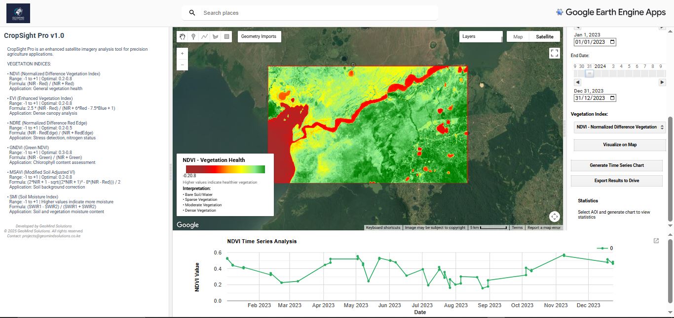
Precision Agriculture
Data-driven solutions for optimized crop management and maximum yields.
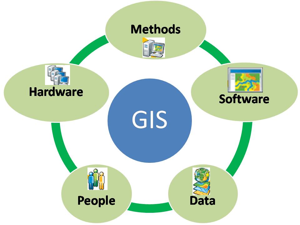
Spatial Computing & APIs
Custom web-GIS solutions and APIs for seamless geospatial integration.
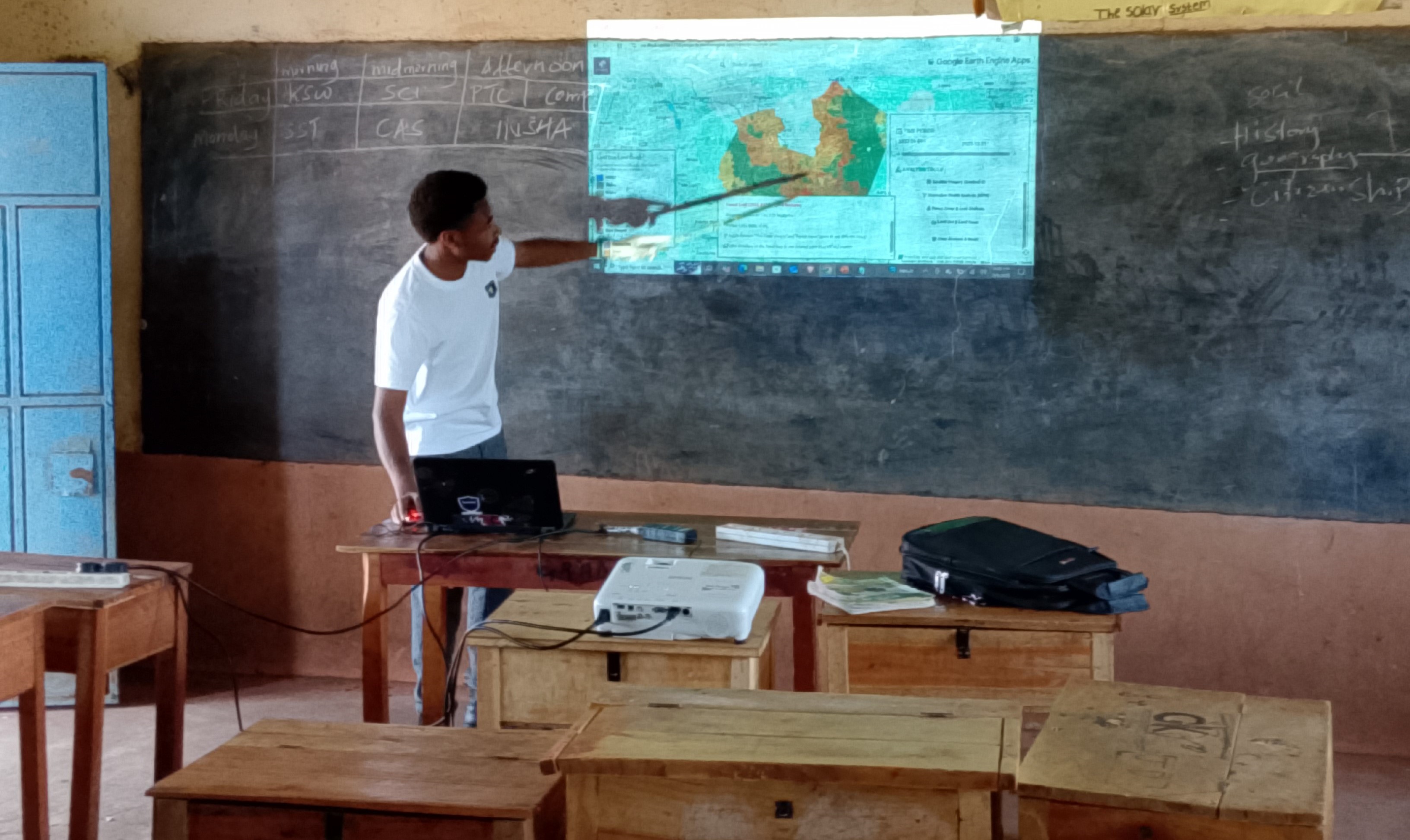
Capacity Building
Expert training in Geospatial technologies, Cartography and Earth observation.
Environmental Monitoring
Advanced satellite-based monitoring solutions for environmental compliance and ecosystem management.
Precision Agriculture
Data-driven farming solutions for optimal crop management and yield optimization.
Innovative Solutions for Complex Challenges
Advanced Technology
Cutting-edge AI and machine learning algorithms for precise Earth observation analysis and predictive insights.
Real-time Insights
Immediate access to actionable insights from satellite data, and integrated monitoring systems.
Customizable Solutions
Tailored geospatial solutions to meet your specific industry requirements and operational needs.
Agricultural Monitoring
Advanced crop monitoring and agricultural intelligence using satellite data for optimized farming practices.
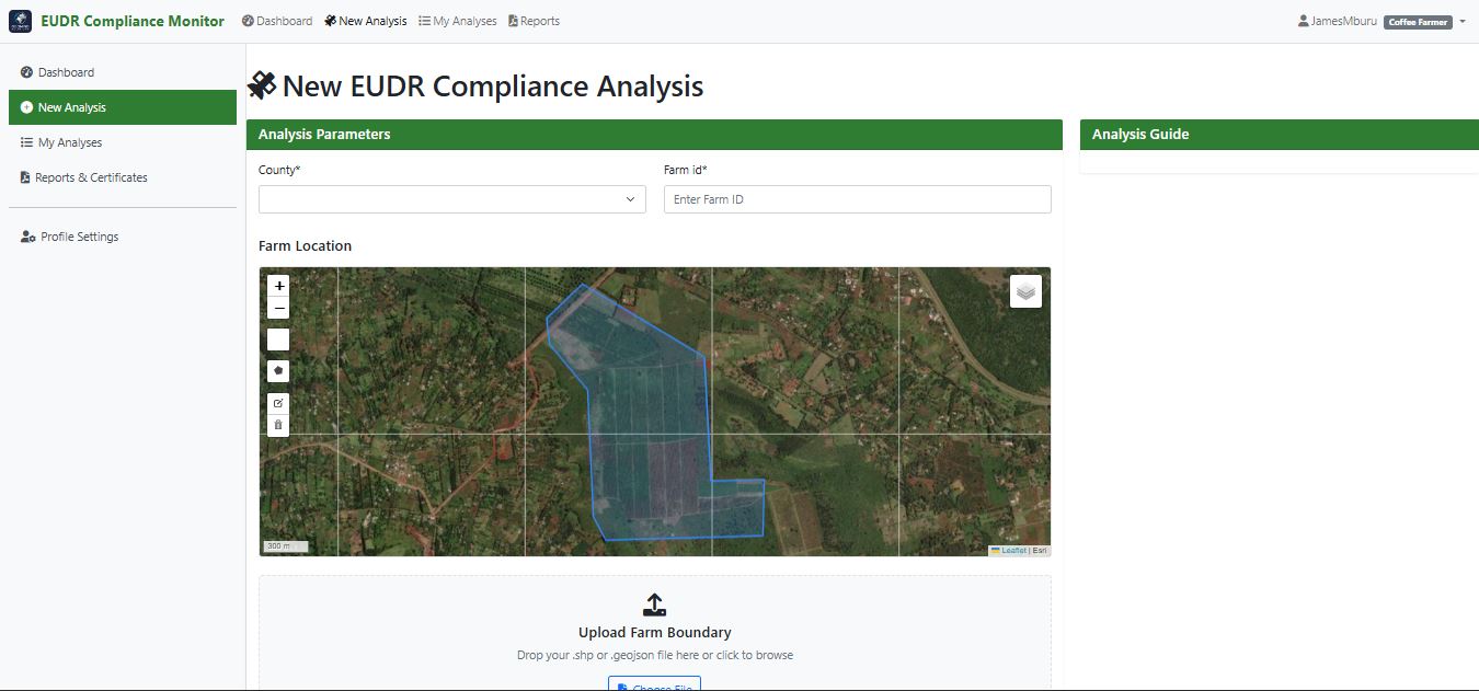
Environmental Compliance
Comprehensive solutions for EUDR compliance and environmental monitoring with real-time tracking.
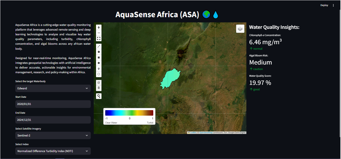
Water Management
Intelligent water resource monitoring and management solutions for sustainable usage.
Smart Mapping
Advanced mapping solutions for informed decision-making and spatial analysis.
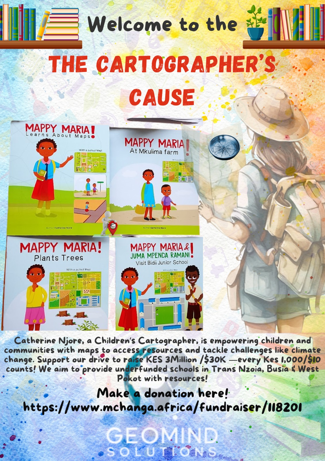
The Cartographers Cause
Empowering communities through geospatial education and cartographic literacy. We believe in making mapping accessible to everyone.
Educational Resources
Free access to cartographic learning materials and workshops
Community Engagement
Supporting local mapping initiatives and projects
Capacity Building
Training programs for sustainable development
Trusted by Leading Organizations


Ready to Transform Your Data?
Join organizations worldwide who trust GeoMind Solutions to turn their Earth observation data into actionable intelligence.
We're here to help you find the right solution for your needs
Call Us
Main Office:
+254 797 816 860
Monday - Friday, 8AM-5PM EAT