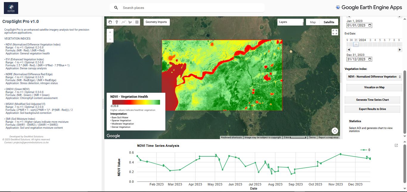
CropSight Pro v1.0
Our flagship agricultural monitoring platform combines satellite imagery with AI-powered analytics to deliver near-real-time insights on crop health, soil moisture, and vegetation indices. Track multiple fields simultaneously and identify potential issues before they become critical.
- Regional crop health analysis
- Soil Moisture Content analysis
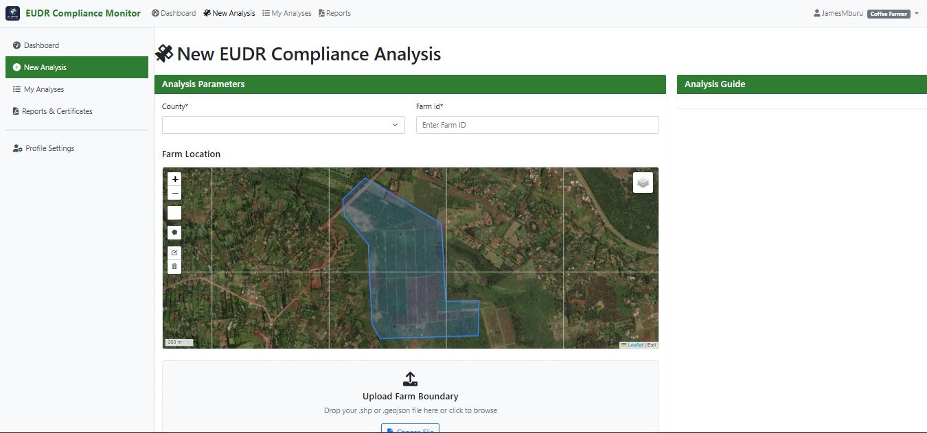
EUDR CoffeeTrack
Satellite-based monitoring for EU Deforestation Regulation compliance. Track land use changes and demonstrate zero-deforestation practices for coffee and other commodities.
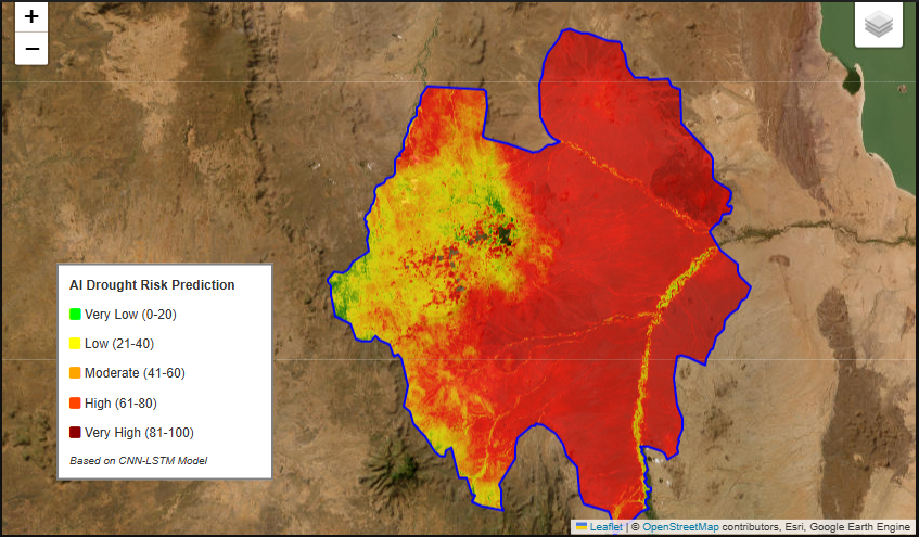
Drought Monitoring & Forecasting
Advanced early warning system predicting drought conditions up to 6 months in advance. Helps farmers and communities prepare for water scarcity.
Key Benefits
Enhanced Decision Making
Data-driven insights powered by AI and satellite imagery enable better farming decisions, improved risk management, and proactive problem solving.
Increased Productivity
Maximize yields through early detection of crop stress, optimized management practices, and predictive analytics that keep you ahead of potential issues.
Who Benefits?
Commercial Farming Operations
Large-scale farms, agricultural cooperatives, and small-holder farmers seeking to optimize yields and reduce costs through data-driven farming practices.
Government & NGOs
Agricultural departments, food security institutions, and development organizations monitoring regional agriculture and implementing food security programs.
Financial Institutions
Banks, insurance companies, and investment firms using agricultural intelligence for risk assessment, crop insurance, and investment decisions.
Ready to Transform Your Agricultural Operations?
Experience the power of precision agriculture with a personalized demonstration tailored to your specific farming needs and challenges.