Integrated solutions covering the full spectrum of climate action needs
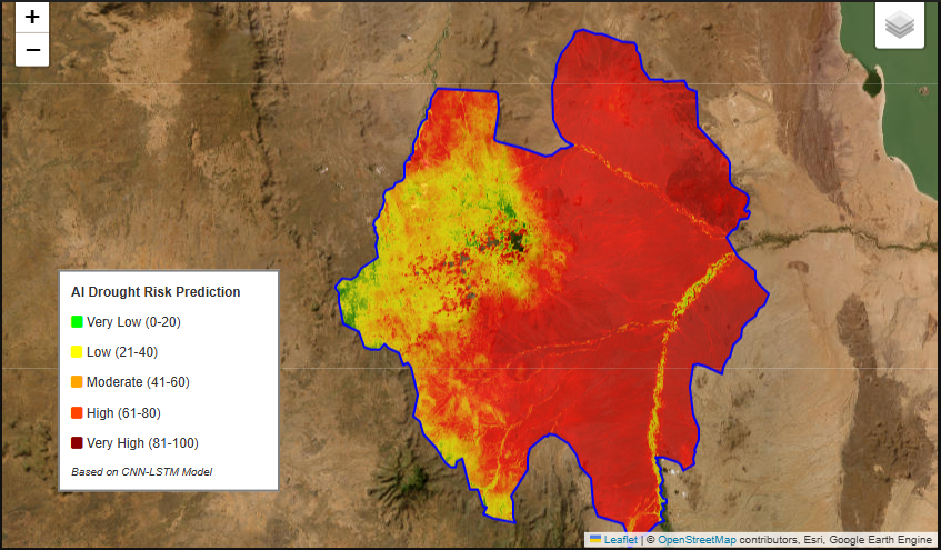
Climate Risk Analysis & Early Warning
Protect communities and infrastructure with advanced climate risk modeling. Our drought monitoring and forecasting systems provide up to 6-month advance warnings, enabling proactive adaptation strategies.
Drought Forecasting: Predictive modeling using satellite data and weather patterns for long-lead warnings
Vulnerability Mapping: Identify climate-vulnerable regions and populations for targeted interventions
Adaptation Planning: Data-driven strategies for building climate resilience
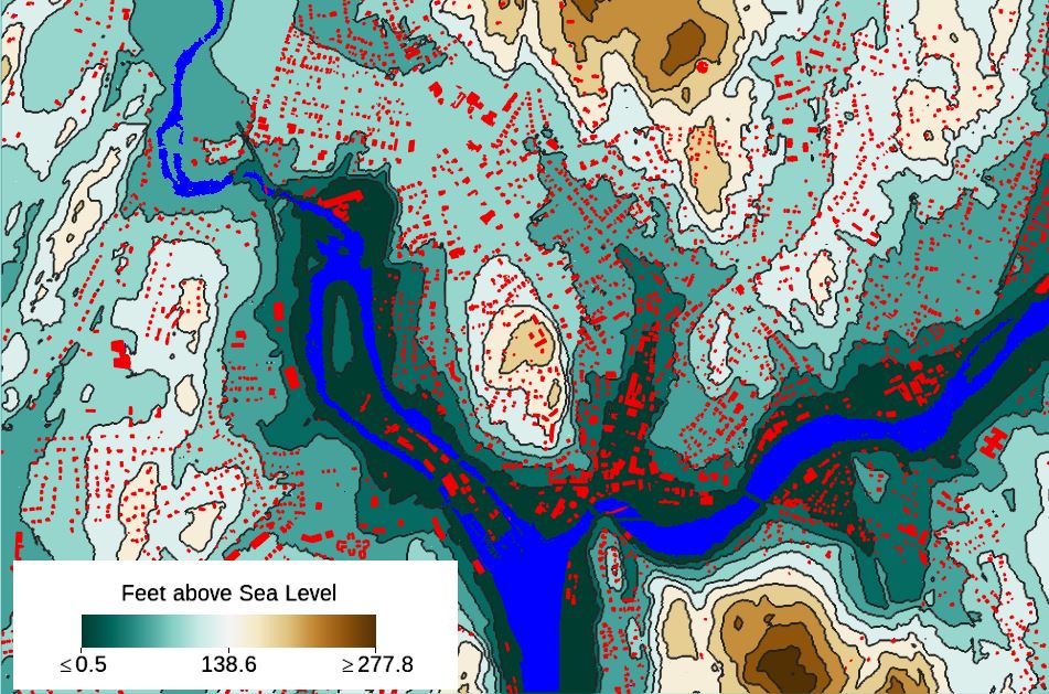
Flood Risk Assessment & Response
Minimize flood impacts through advanced geospatial analysis and real-time monitoring. Our flood management system helps communities, governments, and relief organizations prepare for and respond to flooding events.
Flood-Prone Area Mapping: Identify high-risk zones using terrain analysis and historical data
Near-Real-time Monitoring: Track water levels and flood extent during active events
Impact Assessment: Rapid damage assessment to guide relief efforts