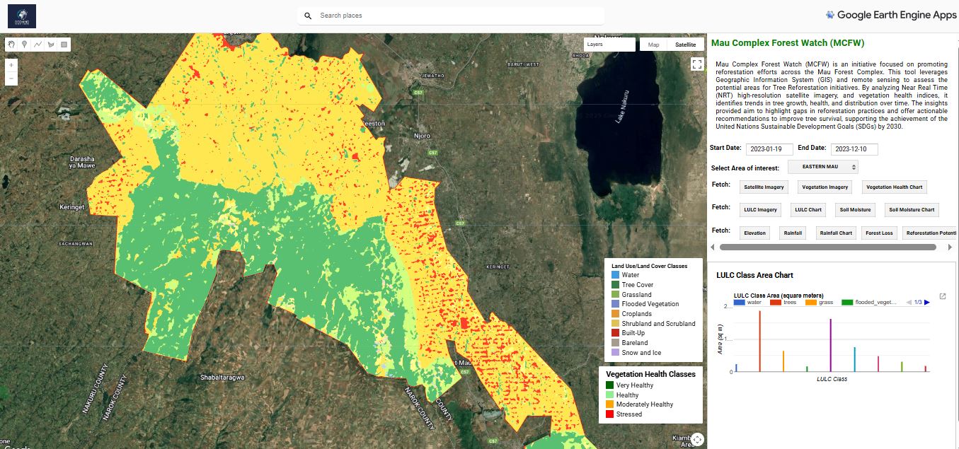
Advanced geospatial solutions combining satellite imagery, AI, and remote sensing for comprehensive forest monitoring, restoration, and sustainable management.
A groundbreaking initiative promoting reforestation across the Mau Forest Complex through advanced GIS and remote sensing technology.
Near Real-Time Monitoring: High-resolution satellite imagery analysis for continuous forest assessment
Vegetation Health Analysis: Advanced indices tracking tree growth, health, and distribution patterns
Actionable Insights: Data-driven recommendations to improve reforestation outcomes and tree survival rates
SDG Alignment: Supporting achievement of UN Sustainable Development Goals by 2030
Mau Forest Complex Reforestation Monitoring
Comprehensive solutions addressing every aspect of sustainable forest stewardship
Real-time satellite monitoring for deforestation detection, forest health assessment, and biomass estimation using advanced remote sensing technology.
Strategic reforestation and restoration planning using GIS analysis to identify optimal areas for tree planting and ecosystem recovery initiatives.
Development and monitoring of forest carbon projects with precise biomass quantification and carbon sequestration tracking for climate action.
Partner with us to implement cutting-edge forestry solutions that deliver measurable environmental, economic, and social impact.